The Manaslu Circuit Trek Route is one of Nepal’s most rewarding long-distance Himalayan trails, circling the world’s eighth-highest mountain, Mount Manaslu (8,163 m). Unlike the busier corridors of Everest and Annapurna, this route passes through a restricted region where infrastructure is minimal, signboards are rare, and the landscape changes quickly due to landslides, river shifts, and seasonal snow. For trekkers, this means the journey is spectacular—but navigation requires awareness, preparation, and an understanding of how the trail actually flows from village to village.
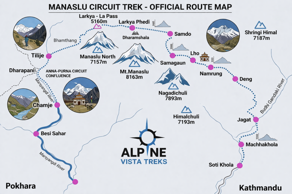
This overview explains the trail’s geography, settlement pattern, terrain behavior, cultural landmarks, and the practical navigation logic that helps you move confidently from the trailhead at Soti Khola to the exit point at Dharapani after crossing Larke La Pass (5,106 m).
Geographic Logic of the Manaslu Circuit Trek Route
Understanding the geographic structure of the region is the first and most powerful navigation tool. The lower half of the Manaslu trail follows the deep gorge carved by the Budhi Gandaki River. This river is your natural compass for nearly five days of trekking. As you ascend, the valley narrows into steep canyon walls, forcing the trail to weave in and out via suspension bridges. Many of these bridges appear similar, and not all of them lead to the main trekking path. Knowing when and why the trail crosses the river is essential.
Past the village of Jagat, the region becomes officially restricted. Permit checkpoints appear, and the cultural environment shifts toward Tibetan-influenced settlements. The valley begins to widen gradually after Deng, and the forests transition from subtropical greenery to pine, fir, and alpine shrubs as altitude increases.
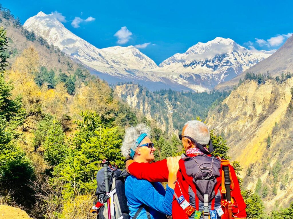
Above Namrung, the mountains reveal themselves. You begin to see Manaslu and the surrounding peaks clearly, and the trail becomes less about river navigation and more about open alpine valley movement, where multiple yak and mule trails can confuse direction.
Settlement Pattern: Your Human Navigation Markers
Villages on the Manaslu Circuit Trek Route are not random; they are spaced at logical day-walk intervals that have been used for centuries by traders and locals. Memorizing the sequence of settlements is a reliable way to track your progress without constantly checking a device.
From south to north, the primary settlements are:
Soti Khola → Machha Khola → Jagat → Deng → Namrung → Lho → Shyala→ Samagaun → Samdo → Dharamsala → Bimthang → Dharapani
- Soti Khola — Road trailhead beside the Budhi Gandaki; subtropical start with riverside lodges and terraced hills.
- Machha Khola — Humid river gorge, stone steps, nearby hot springs, and frequent suspension bridge crossings.
- Jagat — Stone-paved village and permit checkpoint marking entry to the restricted Manaslu region.
- Deng — Valley begins to widen; first strong Tibetan cultural influence and pine forests appear.
- Namrung — Gateway to upper Manaslu with clear mountain views, monasteries, and cooler alpine air.
- Lho — Scenic village with a hilltop monastery and dramatic views of Mount Manaslu.
- Shyala Village — Wide alpine meadow surrounded by peaks; confusing yak trails but superb panoramas.
- Samagaun — Largest settlement; key acclimatization stop with hikes to Manaslu Base Camp and Birendra Lake.
- Samdo — Windy high-altitude village near the Tibetan border; last permanent settlement before the pass.
- Dharamsala (Larke Phedi) — Basic seasonal lodges on glacial terrain; overnight stop before Larke La crossing.
- Bimthang — Broad glacial valley with grassy meadows and views back toward Larke peaks.
- Dharapani — Forested junction village where the trail meets the Annapurna Circuit and road access resumes.
If you know what village should come next, you can quickly recognize if you are drifting onto an incorrect path.
Manaslu Circuit Trek Route – Komoot-Style Day-by-Day Navigation Itinerary
Day 01: Drive Kathmandu → Soti Khola
The journey begins with a scenic drive from Kathmandu to Soti Khola. The road passes through Arughat and rural hill settlements before reaching the Budhi Gandaki River valley. Overnight in a riverside lodge.
Day 02: Soti Khola → Machha Khola
Follow the river upstream through forest trails, waterfalls, and suspension bridges. The path includes stone stair sections and narrow cliffside walks before reaching Machha Khola, a small settlement in a humid gorge.
Day 03: Machha Khola → Jagat
The trail becomes more rugged with river crossings and rocky ascents. After passing hot springs at Tatopani, you reach Jagat, the official entry point to the restricted Manaslu region.
Day 04: Jagat → Deng
Climb stone steps and forested ridges as the valley begins to open. You’ll notice increasing Tibetan cultural influence before arriving at Deng, surrounded by pine forests.
Day 05: Deng → Namrung
The trail ascends steadily through bamboo and rhododendron forests. Mountain views begin to open up near the upper valley before reaching Namrung, a scenic village with monasteries.
Day 06: Namrung → Shyala Village
A steady alpine ascent leads from Namrung into open highland terrain with expanding Himalayan views. The trail passes traditional villages and yak pastures, gradually revealing the first dramatic panorama of Mount Manaslu.
You first reach Lho, known for its hilltop Ribung Monastery and sweeping mountain views, before continuing across wide alpine meadows to Shyala Village, a scenic settlement surrounded by Manaslu, Himal Chuli, and nearby peaks.
Day 07: Shyala Village → Samagaun
Traverse wide yak pastures with panoramic Himalayan views. The trail crosses Shyala Village, a stunning meadow surrounded by peaks, before reaching Samagaun, the main acclimatization hub.
Day 08: Acclimatization Day at Samagaun
Rest day for altitude adaptation. Optional hikes to Manaslu Base Camp or Birendra Lake offer incredible glacier views.
Day 09: Samagaun → Samdo
A short but high-altitude trek through windy, dry landscapes leads to Samdo, close to the Tibetan border.
Day 10: Samdo → Dharamsala (Larke Phedi)
Ascend gradually across barren terrain and glacial valleys to reach Dharamsala (Larke Phedi), the final stop before the pass.
Day 11: Dharamsala → Larke La Pass → Bimthang
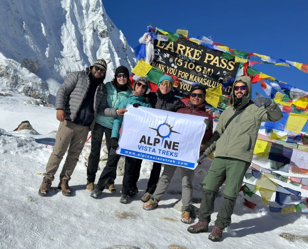
The toughest day of the trek. Early morning ascent to Larke La Pass (5,106 m), followed by a long descent into the lush valley of Bimthang.
Day 12: Bimthang → Dharapani
Descend through forests, rivers, and alpine meadows. The trail gradually becomes easier until reaching Dharapani, where the Manaslu route connects with the Annapurna Circuit road network.
Terrain Behavior and Why Trails Change
A defining feature of the Manaslu Circuit Trek Route is that the trail is alive—it changes every year. Monsoon rains trigger landslides that wipe out sections of path. Local people create temporary detours that later become the “new” trail. Old maps may still show routes that are no longer safe or usable.
In the lower gorge, landslides often force trekkers onto higher forest paths away from the river. Before Deng, there are sections where both a lower riverbank trail and an upper forest trail exist; only one is safe depending on recent conditions.
Above Samdo, snowfall and glacial movement can erase visible tracks entirely. In these sections, trekkers rely on cairns (stone piles), prayer flags, and the experience of guides rather than visible footpaths.
Cultural Landmarks as Directional Clues
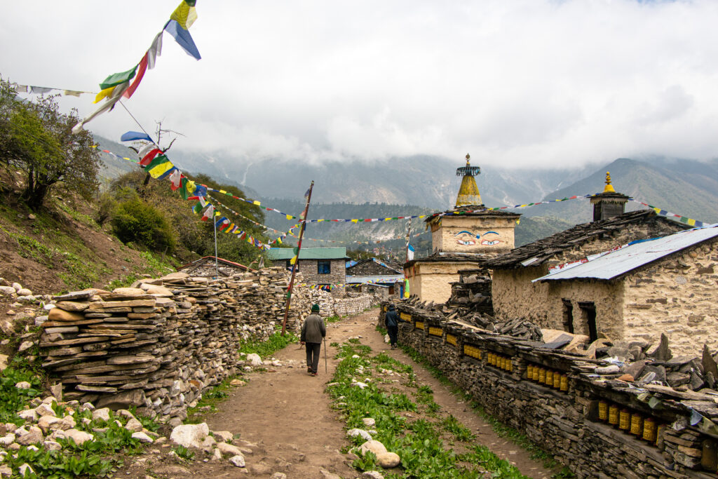
In the upper villages like Lho and Samagaun, you will see mani walls (stone walls carved with Buddhist prayers), chortens, and prayer wheels. These are not just cultural artifacts—they often sit directly on the main trail. Detour paths used by animals or for firewood collection typically lack these markers.
A simple rule: the true trekking route usually passes through the heart of the village near monasteries, water taps, and tea houses, not around the outer edges of fields.
The Transition from River Valley to Alpine Basin
One of the most important navigation shifts happens after Namrung. The Budhi Gandaki is no longer your constant reference. The valley opens into a wide alpine basin where multiple trails created by yaks, mules, and locals spread out across grassy slopes.
Here, trekkers often mistake livestock paths for the trekking trail. The correct route typically stays slightly elevated on the valley side rather than dropping to the flat grazing areas.
The Critical Section: Samdo to Larke La Pass
The stretch from Samdo to Larke La Pass is where most navigation errors occur. The terrain becomes glacial, rocky, and snow-covered depending on the season. The path to Dharamsala is often faint, crossing moraines and seasonal streams.
On pass day, the route is long and gradual but can be completely covered by snow. Without footprints from earlier trekkers or a guide, it is very easy to drift off the correct ascent line.
Prayer flags at the top of the pass are often not visible until you are very close. Trekkers must rely on gradual elevation gain and direction rather than a visible trail.
Descent into Bimthang: Another Confusing Section
After the pass, the descent toward Bimthang crosses glacial valleys where multiple streams braid across the landscape. In foggy weather, the lodge at Bimthang is not visible until the last moment. Many trekkers accidentally follow stream beds too far down instead of contouring toward the settlement.
Why Digital Maps Alone Are Not Enough
Offline GPS apps are useful, but they do not reflect recent landslide detours. The blue dot may show you on the “correct” route while the real trail has shifted 100 meters uphill. This is why combining map awareness with on-ground observation is essential.
Role of Local Knowledge
Local tea house owners and guides always know which section of trail changed after the monsoon or winter. Asking simple questions each morning—“Is the trail okay today?”—provides more accurate information than any printed map.
Mental Navigation Strategy
The best way to navigate the Manaslu Circuit Trek Route is to think in segments:
- River gorge navigation (Soti Khola to Deng)
- Forest and monastery trail (Deng to Namrung)
- Open alpine valley navigation (Namrung to Samdo)
- Glacial and snow navigation (Samdo to Bimthang)
- Forest descent to Annapurna region (Bimthang to Dharapani)
Each segment has different visual cues and challenges.
FAQs: How to Navigate Manaslu Circuit Trek Route
1. Where does the Manaslu Circuit Trek route start?
The trek begins after a drive from Kathmandu to Soti Khola or Machha Khola, which are the first trail entry points into the Budhi Gandaki Valley.
2. How do I identify the correct trekking route on the trail?
The main route follows the Budhi Gandaki River upstream, passing through villages, suspension bridges, and terraced hillsides until Samagaun.
3. Is the Manaslu trekking route clearly marked?
The trail is partially marked, but not fully signposted. Navigation depends on village directions, river flow, and local trail paths rather than official signage.
4. What are the key villages for route navigation?
Important stopping points include Jagat, Deng, Namrung, Lho, Samagaun, Samdo, and Dharamsala, which help confirm you are on the correct path.
5. How do I know I am heading toward Larke Pass?
As you move past Samdo and Dharamsala, the terrain becomes rocky, alpine, and glacier-like, with fewer settlements, indicating approach to Larke Pass (5,106m).
6. Can I do the Manaslu Circuit Trek without a guide?
No, a licensed guide is mandatory in the Manaslu restricted region, and it also significantly improves navigation safety in remote areas.
7. What is the main navigation challenge on this trek?
The biggest challenge is route ambiguity in forest sections and high alpine terrain, especially between Deng and Namrung and near Larke Pass.
8. Is mobile GPS reliable on the Manaslu route?
GPS can be used for tracking, but signal coverage is weak or unavailable in many sections, so it should not be relied on as the only navigation tool.
9. What natural features help with navigation?
The river direction, valley walls, suspension bridges, and village clusters act as natural guides throughout the journey.
10. What happens after crossing Larke Pass?
After crossing Larke Pass, the trail descends into Bimthang and continues toward Dharapani, where it connects with the Annapurna region road network.
Final Perspective
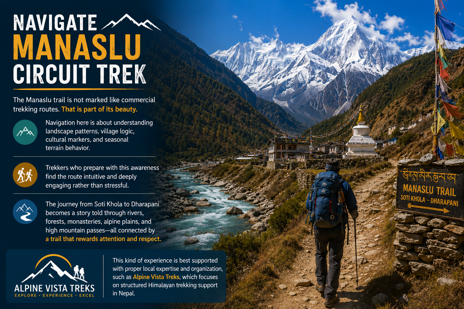
The Manaslu trail is not marked like commercial trekking routes. That is part of its beauty. Navigation here is about understanding landscape patterns, village logic, cultural markers, and seasonal terrain behavior.
Trekkers who prepare with this awareness find the route intuitive and deeply engaging rather than stressful. The journey from Soti Khola to Dharapani becomes a story told through rivers, forests, monasteries, alpine plains, and high mountain passes—all connected by a trail that rewards attention and respect. This kind of experience is best supported with proper local expertise and organization, such as Alpine Vista Treks, which focuses on structured Himalayan trekking support in Nepal.