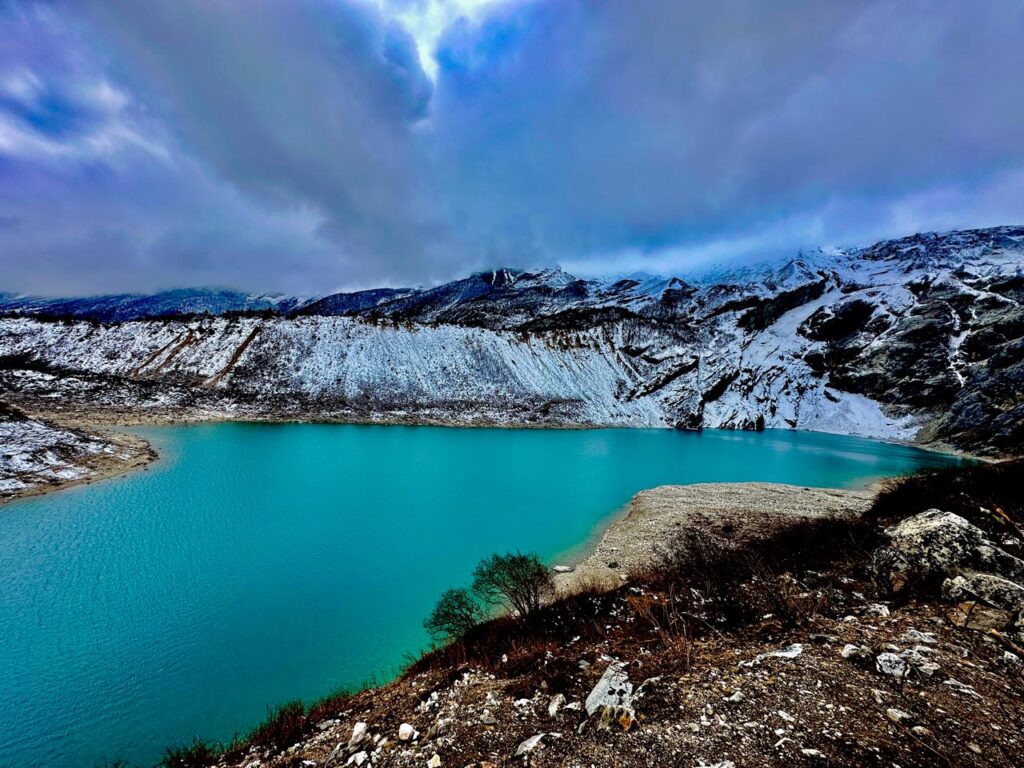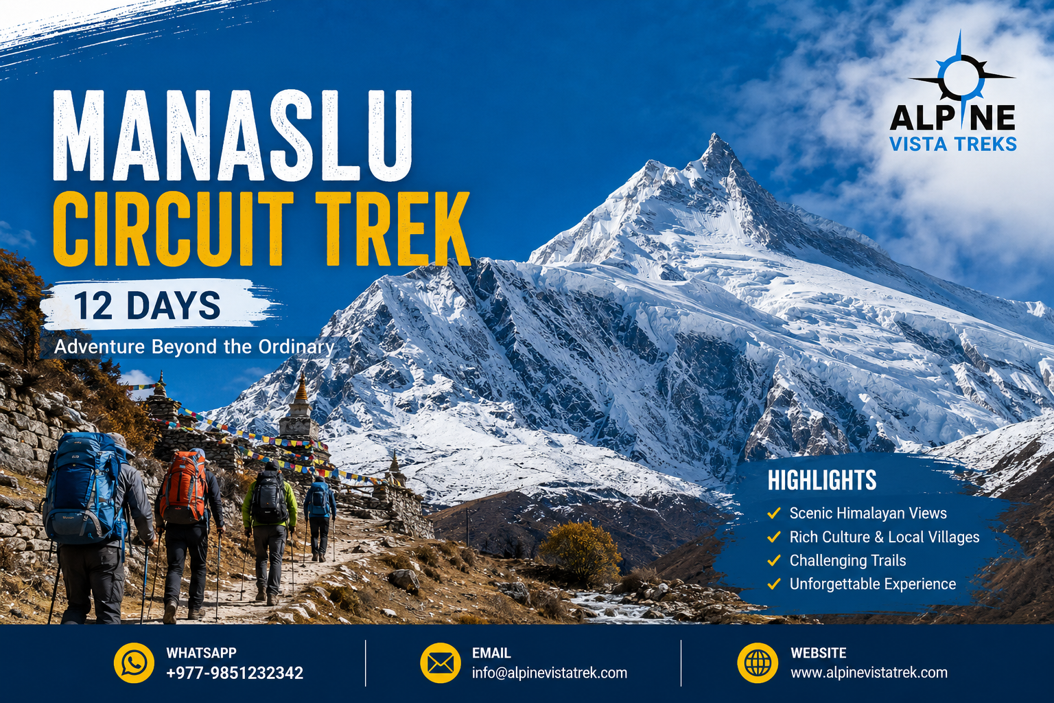
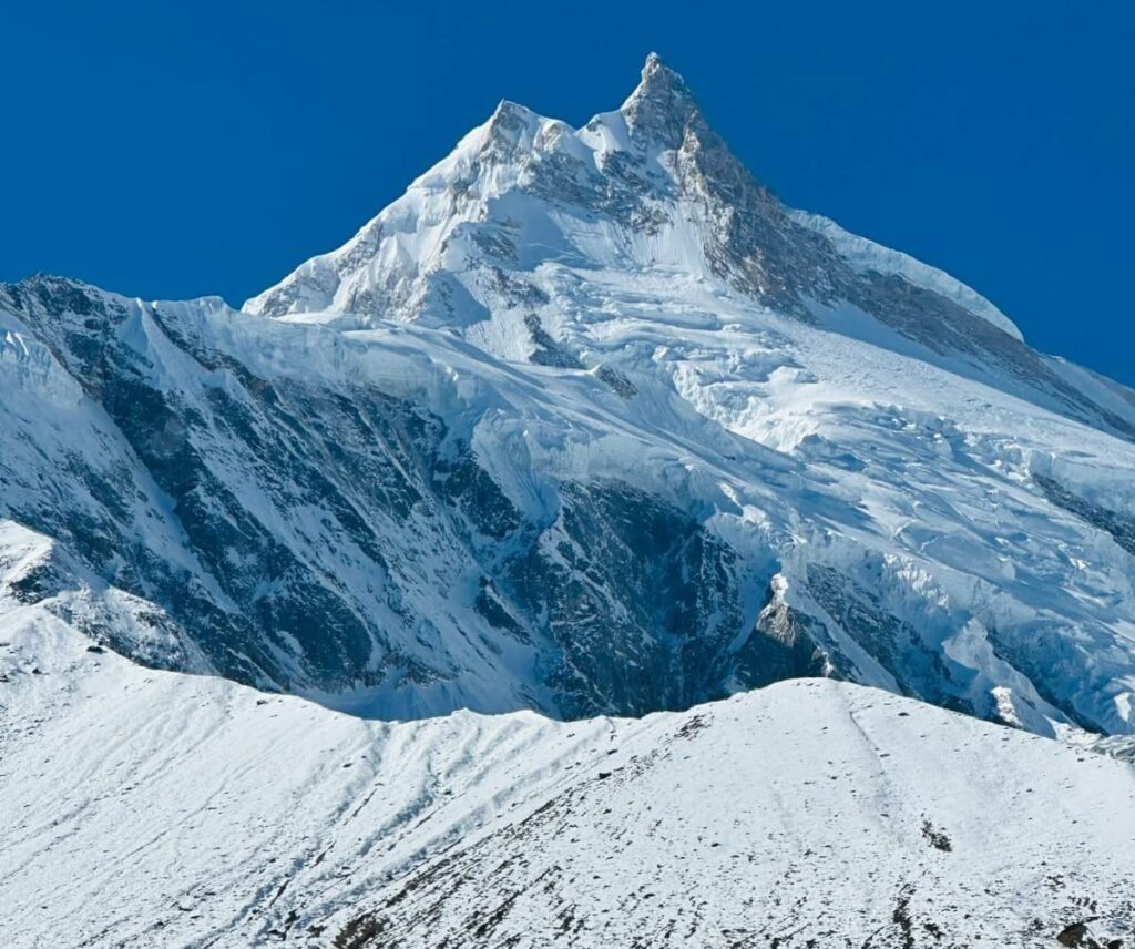
The Manaslu Circuit Trek stands as a premier high-altitude mountaineering and trekking expedition located in the northern Himalayan territory of the Gorkha District in Nepal. Geographically, the route circumnavigates Mount Manaslu, the eighth-highest peak in the world, which reaches an imposing elevation of 8,163 meters (26,781 feet). Derived from the Sanskrit term “Manasa,” meaning “Intellect” or “Soul,” the mountain anchors a deeply spiritual and ecologically diverse region that was officially opened to foreign trekkers only in 1992.
Spanning an average distance of 177 kilometers, the comprehensive 12-day itinerary demands traversing a spectacular gradient of ecological zones. Trekkers begin in the humid, subtropical river valleys of the lower Budi Gandaki gorge, ascend through temperate broadleaf and coniferous forests, and ultimately reach the nival (permanent snow) zones above 5,000 meters. Unlike the heavily commercialized Annapurna and Everest Base Camp circuits, the Manaslu Circuit operates under a stringent restricted-area framework mandated by the Nepalese government. This regulatory infrastructure serves a dual purpose: it mitigates the environmental degradation typically associated with mass tourism while preserving the delicate ethno-historical fabric of the resident Nubri and Tsum communities. The expedition culminates in the crossing of the Larkya La Pass, a formidable high-altitude saddle sitting at 5,106 meters (frequently recorded as 5,160 meters), representing the topographical and physiological crux of the journey.
Key Highlights of the Manaslu Circuit Trek 12 Days
The allure of the Manaslu Circuit is defined by a synthesis of raw geological majesty and profoundly preserved cultural heritage. The following seven highlights represent the core qualitative experiences of the 12-day circuit.
Continuous Topographical Exposure to the Manaslu Massif
Throughout the circuit, trekkers are afforded continuous, evolving perspectives of the high Himalayas. Beyond Mount Manaslu (8,163m), the skyline is dominated by a congregation of towering giants, including Himal Chuli (7,893m), Ngadi Chuli (7,871m), Siring Himal (7,165m), and the Annapurna II range. The changing angles of these peaks, particularly the iconic double-peak summit of Manaslu from the village of Lho, provide a constant visual reminder of the region’s immense scale.
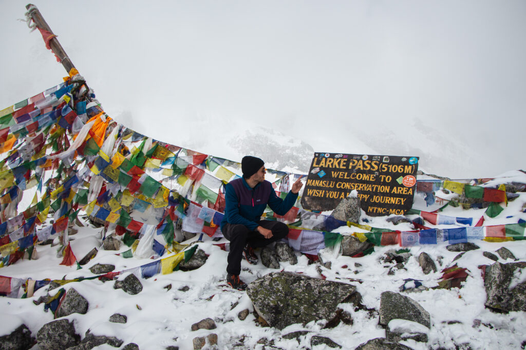
The Larkya La Pass Crossing (5,106m)
Serving as the highest point of the trek, the Larkya La Pass is a test of physical endurance and psychological resilience. The ascent requires a pre-dawn start to avoid high-velocity diurnal winds, pushing trekkers through freezing temperatures and oxygen-depleted air. The summit ridge, however, offers an unparalleled, uninterrupted panoramic vantage point of the Himlung Himal (7,126m), Cheo Himal (6,820m), and Gyaji Kang.
Deep Gorge Navigation along the Budi Gandaki River
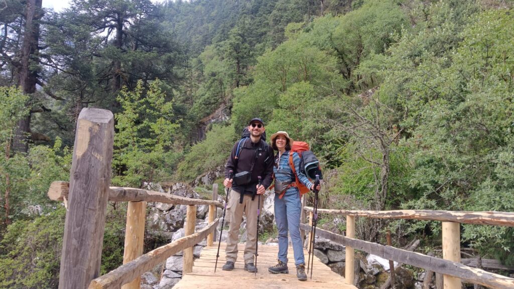
Before reaching the alpine expanse, the trail traces the Budi Gandaki River, one of the deepest and most dramatic river gorges in the Himalayas. The route requires navigating ancient trade paths carved into sheer cliff faces and crossing numerous modern cantilever and traditional suspension bridges that sway high above the torrential glacial meltwaters.
Cultural Preservation in the Nupri Valley
The upper reaches of the trek, specifically from Namrung to Samdo, encapsulate the Nupri Valley—a region operating as an extension of the Tibetan cultural sphere. Trekkers traverse settlements functioning as living museums of Vajrayana Buddhism, where the trails are lined with intricately carved mani walls, ancient chortens, and water-driven prayer wheels. The architecture shifts from bamboo to solid stone masonry, reflecting a society adapted to severe alpine winters.
The Spiritual Sanctuary of Pungyen Gompa
Situated at an elevation of 4,000 meters in a lateral valley near Samagaon, Pungyen Gompa is an ancient monastery nestled directly beneath the imposing north face of Mount Manaslu. Bearing the scars of a 1934 avalanche and the 2015 earthquake, the gompa remains the spiritual nexus of the valley. It is steeped in local folklore, including legends of Yeti artifacts, and serves as the epicenter for local Tibetan Buddhist festivals such as Losar.
Biodiversity within the Manaslu Conservation Area (MCAP)
The entire trekking route lies within the Manaslu Conservation Area, a 1,663-square-kilometer sanctuary established in 1998. This ecological hotspot supports over 1,500 to 2,000 plant species across 11 distinct forest types. Trekkers frequently observe exotic avifauna, such as the Himalayan Monal, and the strict local hunting bans protect endangered mammals, including the elusive snow leopard, the red panda, and the Himalayan blue sheep (bharal).
Sustained Wilderness and Solitude
Despite an increase in global recognition, the mandatory permit requirements and lack of independent trekking options artificially cap the visitor volume. This ensures that the Manaslu Circuit remains one of Nepal’s least crowded major trekking routes. Trekkers can walk for hours in total isolation, accompanied only by the sound of the wind and the river—a profound contrast to the high-traffic bottlenecks frequently experienced on the Everest Base Camp trail.
What to Expect on a 12-Day Manaslu Circuit Trek
Undertaking the Manaslu Circuit within a compressed 12-day timeframe requires an understanding of the immense physical, logistical, and environmental realities of the trail. This is not a leisurely holiday; it is an active alpine expedition requiring sustained daily output.
Physiologically, trekkers must anticipate extended daily walking periods averaging 6 to 8 hours, covering distances ranging from 10 to 24 kilometers per day over highly uneven, rugged terrain. The trail features continuous, punishing ascents and descents over loose scree, rocky glacial moraines, and exposed cliff-side paths. Cumulative fatigue is a significant factor, as the body operates in a constant caloric deficit while carrying a daypack and fighting the debilitating effects of altitude. Above 3,500 meters, the effective atmospheric oxygen concentration decreases by over 35%, making every cardiovascular exertion exponentially more difficult.
Environmentally, the rapid ecological transition subjects the body to extreme temperature fluctuations. Trekkers will begin the journey sweating in the humid 25°C subtropical heat of the lowlands, only to face biting -15°C to -20°C wind chills a few days later near Dharamsala and Larkya La Pass.
Logistically, accommodations consist entirely of basic teahouses. While lower villages may offer rudimentary attached bathrooms, the infrastructure degrades significantly as altitude increases. In high-altitude settlements like Samagaon and Samdo, rooms feature uninsulated plywood walls and simple twin beds with thin mattresses. Central heating is non-existent in the bedrooms; all warmth is localized to the communal dining halls, which are heated for a few hours each evening using iron stoves fueled by yak dung or dried scrub. Showers, where available, are bucket-style and require an additional fee, while diets become highly repetitive, relying heavily on carbohydrate-dense local staples like Dal Bhat.

Manaslu Circuit Trek Itinerary 12 Days: Route and Map Analysis
The 12-day itinerary demands precise daily pacing to successfully balance the substantial geographical distance (177 kilometers) with the absolute necessity of physiological acclimatization. The following breakdown details the spatial progression, elevation profiles, and terrain dynamics of the expedition.
Day 1: Drive from Kathmandu to Machha Khola
| Parameter | Detail |
| Start Elevation | 1,400m (Kathmandu) |
| End Elevation | 870m (Machha Khola) |
| Distance & Time | 140–160 km / 7–10 hours |
The expedition initiates with a complex vehicular transfer from the capital city of Kathmandu to the trekking trailhead at Machha Khola. The journey begins on the relatively smooth, paved Prithvi Highway, heading toward Dhading Besi. However, as the route diverts into the rural hinterlands toward Arughat, the infrastructure shifts to highly degraded, unpaved mountain dirt tracks. The vehicle navigates precipitous cliffs alongside the Trishuli and Budi Gandaki rivers. Machha Khola is a vibrant, subtropical riverside settlement where the humidity is high, and trekkers utilize their first teahouse accommodations to prepare for the active hiking phase.
Day 2: Trek to Jagat
| Parameter | Detail |
| Start Elevation | 870m (Machha Khola) |
| End Elevation | 1,340m (Jagat) |
| Distance & Time | 22 km / 6–7 hours |
The first day of active trekking involves a substantial distance of approximately 22 kilometers. The trail meanders through dense, humid subtropical forests, crossing minor landslip zones and ascending via steep, stone-carved staircases. The route passes through traditional Gurung settlements such as Yaru Besi and incorporates the crossing of an impressive modern cantilever bridge pinned to the gorge wall. The day concludes at Jagat, a picturesque village characterized by beautifully paved slate-stone streets. Jagat is of critical bureaucratic importance, as it serves as the official entry checkpoint where the Manaslu Restricted Area Permits (MRAP) are rigorously verified by government officials.
Day 3: Trek to Deng
| Parameter | Detail |
| Start Elevation | 1,340m (Jagat) |
| End Elevation | 1,860m (Deng) |
| Distance & Time | 19 km / 6–7 hours |
Leaving Jagat, the gorge narrows dramatically, and the Budi Gandaki River becomes a roaring torrent below. Over the course of 19 kilometers, the trail undulates heavily, testing the trekkers’ cardiovascular endurance. The vegetation begins a subtle shift from broadleaf subtropics to thick bamboo forests and interspersed pine. Reaching the village of Deng at 1,860 meters marks a vital cultural transition point; it is here that the Hindu influences of the lower hills wane, and the Tibetan Buddhist aesthetics of the upper mountains begin to dominate the architectural and spiritual landscape.
Day 4: Trek to Namrung
| Parameter | Detail |
| Start Elevation | 1,860m (Deng) |
| End Elevation | 2,630m (Namrung) |
| Distance & Time | 19 km / 6–7 hours |
The ascent to Namrung is marked by a steep vertical gain that forces trekkers into the cool, temperate ecological zone. The trail weaves through dense forests of oak and spectacular rhododendron groves, which erupt in vibrant pink and red blooms during the spring. Namrung (2,630m) acts as the gateway to the Nupri Valley. It is a highly significant administrative and visual milestone, serving as a secondary police checkpoint and offering trekkers their first unobstructed, awe-inspiring views of the high Himalayan peaks, including Siring Himal and Ganesh Himal.
Day 5: Trek to Syala
| Parameter | Detail |
| Start Elevation | 2,630m (Namrung) |
| End Elevation | 3,500m (Syala) |
| Distance & Time | 13–14 km / 5–6 hours |
Departing Namrung, the landscape opens up as the dense forests thin into sparse subalpine vegetation. The Tibetan cultural presence becomes absolute. The trail passes through the village of Lho (3,180m), home to the prominent Ribung Gompa and spectacular views of the Manaslu’s bifurcated summit. The trek continues upward to Syala, a sprawling village situated at 3,500 meters. Syala is widely considered the ultimate panoramic viewpoint of the circuit, surrounded by a 360-degree amphitheater of glacial giants including Mt. Manaslu, Himal Chuli, and Naike Peak.
Day 6: Trek to Samagaon via Pungyen Gompa
| Parameter | Detail |
| Start Elevation | 3,500m (Syala) |
| End Elevation | 3,530m (Samagaon) |
| Distance & Time | 17 km / 6–7 hours (including detour) |
This day incorporates a strategic high-altitude detour vital for both cultural immersion and physiological acclimatization. Instead of walking directly to Samagaon, trekkers divert upward toward the ancient Pungyen Gompa, situated on a dramatic ridge at 4,000 meters. The monastery sits directly beneath the sheer, glaciated north face of Mount Manaslu. After exploring the spiritually charged ruins and active prayer halls of the gompa, trekkers descend into Samagaon (3,530m). Samagaon is the principal administrative and cultural hub of the Nubri people, characterized by extensive stone-walled potato and barley fields.
Day 7: Acclimatization Day at Samagaon
At 3,530 meters, atmospheric pressure drops significantly, necessitating a mandatory rest day to prevent Acute Mountain Sickness (AMS). However, “rest” in mountaineering parlance requires active exertion to stimulate erythropoiesis (red blood cell production). Trekkers abide by the “climb high, sleep low” doctrine. Typical acclimatization hikes include a 3-kilometer round trip to the milky, glacial waters of Birendra Lake, or a grueling 12-kilometer, 6-hour round trip ascent to Manaslu Base Camp (4,800m), before returning to the relative oxygen density of Samagaon to sleep.
Day 8: Trek to Samdo
| Parameter | Detail |
| Start Elevation | 3,530m (Samagaon) |
| End Elevation | 3,860m (Samdo) |
| Distance & Time | 8–10 km / 3–4 hours |
The journey from Samagaon to Samdo is intentionally short, covering only 8 to 10 kilometers. The brevity allows the body to cope with the severe altitude gain. The terrain shifts dramatically into a wide, barren, nival valley entirely devoid of tall vegetation, exposing trekkers to relentless high-altitude solar radiation and wind. Samdo (3,860m) is an ancient Tibetan refugee settlement located just a few hours’ walk from the porous Lajyung Bhanjyang border pass into Tibet, retaining deep historical ties to the trans-Himalayan salt trade.
Day 9: Trek to Dharamsala (High Camp)
| Parameter | Detail |
| Start Elevation | 3,860m (Samdo) |
| End Elevation | 4,460m (Dharamsala) |
| Distance & Time | 6–8 km / 3–4 hours |
Continuing the cautious ascent protocol, the trek to Dharamsala (also known as Larkya Phedi) covers merely 6 to 8 kilometers. The path traces the lateral moraine of the Larkya Glacier, revealing jagged icefalls and sweeping views of the Siachen Glacier. Dharamsala (4,460m) is not a permanent village but a seasonal staging camp designed solely to shelter trekkers before the pass crossing. The combination of extreme elevation, sub-zero temperatures, and thin air makes this stop the most physically uncomfortable night of the expedition.
Day 10: Cross Larkya La Pass and Trek to Bimthang
| Parameter | Detail |
| Start Elevation | 4,460m (Dharamsala) |
| Peak Elevation | 5,106m (Larkya La Pass) |
| End Elevation | 3,720m (Bimthang) |
| Distance & Time | 22–24 km / 8–10 hours |
Day 10 represents the climax of the Manaslu Circuit. To avoid the highly dangerous, gale-force diurnal winds that sweep the pass by mid-morning, trekkers must mobilize between 3:00 AM and 4:00 AM. The ascent is a brutal, sustained climb up a steep, rocky moraine under the illumination of headlamps. At the summit of Larkya La (5,106m), temperatures can plummet to -20°C. Trekkers are rewarded with an immense geographical threshold, standing exactly between the Manaslu and Annapurna mountain ranges, with jaw-dropping views of Cheo Himal and Kang Guru.
The subsequent descent to Bimthang (3,720m) is equally grueling. It is a massive 1,400-meter vertical drop over loose, glacial scree that places immense kinetic stress on the knees and quadriceps. After 8 to 10 hours of continuous movement, arriving in the beautiful, pasture-laden valley of Bimthang offers profound physical relief.
Day 11: Trek to Tilije
| Parameter | Detail |
| Start Elevation | 3,720m (Bimthang) |
| End Elevation | 2,300m (Tilije) |
| Distance & Time | 18–20 km / 6–7 hours |
From Bimthang, the trail descends rapidly back into the oxygen-rich tree line. The 18 to 20-kilometer hike follows the course of the Dudh Khola river, plunging back through dense, temperate scrub forests and towering pine stands. The sudden increase in barometric pressure acts as a powerful restorative force for exhausted trekkers. The day ends at Tilije (2,300m), a vibrant agricultural village where the architecture transitions away from the blocky Tibetan style back to the intricately carved woodwork of the lower-hill ethnic groups.
Day 12: Drive to Besisahar and Return to Kathmandu
The physical hiking component concludes with a brief walk from Tilije down to Dharapani (1,960m), where the Manaslu Circuit intersects with the famous Annapurna Circuit trail. Here, the Annapurna Conservation Area Permits (ACAP) are officially checked and stamped. From Dharapani, trekkers board local shared 4×4 jeeps to navigate the highly rugged, cliff-hugging mountain road down the Marsyangdi River valley to the town of Besisahar. At Besisahar, the group transfers to a comfortable microbus or private vehicle for the long, 5-to-8-hour drive along the paved Prithvi Highway, returning to Kathmandu and officially concluding the 12-day expedition.
Manaslu Circuit Trek Difficulty Level Explained
The Manaslu Circuit is universally classified within the mountaineering community as a “Moderate to Challenging” or “Strenuous” trek. The difficulty algorithm is a composite of three relentless primary factors: distance, terrain, and altitude.
- Distance and Duration: Walking approximately 177 kilometers over 12 consecutive days requires highly sustained muscular and cardiovascular endurance. Unlike sea-level hiking, the body has minimal time to repair micro-tears in muscle tissue, leading to compounding fatigue as the days progress.
- Topographical Terrain: The trails are rarely flat. Trekkers face continuous, aggressive ascents and descents. The underfoot conditions range from muddy forest tracks to highly unstable scree slopes, exposed cliff edges, and boulder-strewn glacial moraines. The descent from Larkya La Pass, dropping 1,400 vertical meters over rocky terrain in a single afternoon, is notoriously punishing on the patellar tendons and knee joints.
- Extreme Altitude: The ultimate arbiter of difficulty is the barometric pressure. At the Larkya La Pass (5,106m), the atmosphere contains roughly 50% of the effective oxygen available at sea level. This hypoxia restricts VO2 max (the maximum rate of oxygen consumption), rendering basic uphill walking utterly exhausting and initiating symptoms of Acute Mountain Sickness in underprepared individuals.
Who Can Do This Trek?
The rigorous demands of the 12-day Manaslu Circuit mean it is not suitable for absolute novices with zero hiking experience. The ideal demographic for this trek falls into the following categories:
- Experienced Alpine Hikers: Individuals who have previously completed multi-day, high-altitude treks (such as the Annapurna Circuit, Everest Base Camp, or Mount Kilimanjaro) and intimately understand how their physiology reacts to sustained exertion and thin air.
- Highly Conditioned Beginners: Novices who possess excellent baseline cardiovascular fitness (e.g., marathon runners, triathletes, or individuals engaging in heavy, sustained endurance training) and have dedicated several months to rigorous physical preparation involving loaded backpack hikes on steep inclines.
- Psychologically Adaptable Travelers: Beyond physical fitness, the trek requires immense mental resilience. Trekkers must possess the psychological fortitude to tolerate primitive sanitation facilities, consecutive days without hot water, highly repetitive diets, and the mental grind of walking through physical discomfort in freezing conditions.
Why Choose Alpine Vista Treks
Executing a seamless high-altitude expedition requires flawless logistics, intimate local knowledge, and an unwavering commitment to safety. Alpine Vista Treks, a government-registered agency operating out of Thamel, Kathmandu, has established itself as a premier operator for the Manaslu region.
The analytical breakdown of their operational model highlights several structural advantages for trekkers:
- Proactive Risk Management: Their government-licensed guides do not simply lead the way; they act as mobile safety officers. Guides are equipped with comprehensive medical kits, pulse oximeters to monitor oxygen saturation, and satellite/CDMA communication devices to swiftly coordinate emergency helicopter evacuations in the event of severe altitude sickness.
- Ethical Labor Practices: The company operates on a strict ethical philosophy regarding their support staff. They guarantee fair wages, restrict porter loads to safe limits, and ensure all guides and porters are provided with specialized high-altitude clothing and insurance—a crucial factor in the frozen upper valleys.
- Logistical Supremacy: Managing a trek in a restricted area involves navigating complex government bureaucracy. Alpine Vista Treks expertly handles the acquisition of all MRAP, MCAP, and ACAP permits using the digital e-TIMS system, arranges reliable private jeep transportation to the trailhead, and pre-books highly scarce teahouse accommodations during the chaotic peak seasons.
- Customization and Group Dynamics: Led by industry veteran Binod Osti, the company limits group sizes to ensure highly personalized service and offers flexible, tailor-made itineraries that allow trekkers to adapt the pace to their specific acclimatization needs.
Best Time for Manaslu Circuit Trek: Weather, Season & Visibility Guide
Meteorological conditions in the Himalayas dictate not only the visual splendor of the trek but its absolute safety and feasibility. The Manaslu region operates on a stark seasonal cycle, offering two primary optimal trekking windows.
| Trekking Season | Months | Visibility & Atmospheric Dynamics | Temperature Range (High Altitudes) |
| Autumn (Peak) | Sept to Nov | The ultimate trekking season. Post-monsoon atmospheric scrubbing leaves the air entirely devoid of dust, offering the sharpest, most crystalline mountain views. Weather patterns are highly stable with minimal precipitation. | 10°C to 15°C (Days) / Drops to -10°C to -15°C (Nights) |
| Spring (Sub-Peak) | March to May | Exceptional visibility, though occasional afternoon haze may occur. The ecological draw is immense as the temperate valleys explode with vibrant red and pink rhododendron blooms. Melting snow at higher elevations may still require microspikes at Larkya La. | 15°C to 20°C (Days) / Drops to -5°C (Nights) |
| Winter (Off-Season) | Dec to Feb | Highly treacherous. Extreme cold and deep snowdrifts frequently render the Larkya La pass completely impassable. Many teahouse owners migrate to lower elevations, closing their lodges. | Sub-zero daily / Plummets to -20°C to -30°C (Nights) |
| Monsoon (Off-Season) | June to Aug | Strictly unadvisable. The Budi Gandaki gorge funnels heavy monsoon rains, triggering severe and deadly landslides that obliterate the trail. The paths are muddy, infested with leeches, and thick cloud cover obscures all mountain views. | Warm and highly humid |
Manaslu Circuit Trek Permits Explained: RAP, MCAP & ACAP Guide 2026
Because the Manaslu region directly borders the sensitive Tibet Autonomous Region, it falls under an intensely regulated restricted area framework. Bureaucratic compliance is mandatory and strictly enforced at military and police checkpoints throughout the trail.
The March 22, 2026 Regulatory Paradigm Shift
On March 22, 2026, the Nepal Department of Immigration enacted profound legislative updates regarding the Manaslu Restricted Area Permit (MRAP).
Historically, the government mandated a minimum of two foreign trekkers to issue an MRAP. This draconian rule forced solo travelers to either hire “ghost partners” (paying for a fictitious second person’s permit) or join groups of strangers. The 2026 update officially eradicated this requirement. A solo traveler (constituting a group size of one) is now legally permitted to apply for and obtain the MRAP.
However, regulatory semantics are critical here: “solo” does not mean “independent.” The strict legal requirement to be accompanied by a government-licensed Nepali guide remains absolute; independent, unguided trekking is strictly prohibited and will result in immediate expulsion at the Jagat checkpoint. Furthermore, all permits must be processed via a TAAN-registered trekking agency through the newly implemented digital e-TIMS system using the traveler’s visa application number. Self-application by tourists remains forbidden.
Mandatory 2026 Permits and Fee Structure
| Permit Classification | Issuing Authority | Cost (Peak Season: Sept–Nov) | Cost (Off-Season: Dec–Aug) |
| Manaslu Restricted Area Permit (MRAP) | Dept. of Immigration (Kathmandu) | USD 100 for the first 7 days + USD 15 per additional day | USD 75 for the first 7 days + USD 10 per additional day |
| Manaslu Conservation Area Permit (MCAP) | Nepal Tourism Board | USD 30 (Flat Fee) | USD 30 (Flat Fee) |
| Annapurna Conservation Area Permit (ACAP) | Nepal Tourism Board | USD 30 (Flat Fee) | USD 30 (Flat Fee) |
Manaslu Circuit Trek Acclimatization Guide: How to Avoid Altitude Sickness
Altitude sickness, encompassing Acute Mountain Sickness (AMS), High-Altitude Pulmonary Edema (HAPE), and High-Altitude Cerebral Edema (HACE), poses the most severe, life-threatening physiological threat on the circuit. At 5,000 meters, the barometric pressure drops so significantly that each breath delivers a fraction of the oxygen required for normal cellular respiration.
The 12-day itinerary utilizes biological adaptation protocols to mitigate this risk:
- The “Climb High, Sleep Low” Doctrine: The mandatory rest day in Samagaon (3,530m) involves hiking up to a higher elevation, such as Pungyen Gompa (4,000m) or Manaslu Base Camp (4,800m), and then returning to the lower elevation of 3,530m to sleep. This deliberate, temporary hypoxic stress stimulates the kidneys to release the hormone erythropoietin, which accelerates red blood cell production, enhancing oxygen transport without subjecting the body to dangerous sleep hypoxia.
- Aggressive Hydration: Trekkers must consume 3 to 4 liters of water daily. Respiratory water loss at high altitudes is immense due to the hyperventilation required to intake oxygen in cold, dry alpine air. Dehydration severely thickens the blood, exacerbating the risks of frostbite and AMS.
- Pharmacological Intervention: The prophylactic use of Acetazolamide (Diamox) is highly recommended and widely practiced. Diamox acidifies the blood by acting as a carbonic anhydrase inhibitor. This mild metabolic acidosis tricks the respiratory control center in the brain into increasing the depth and rate of ventilation, thus forcibly boosting blood oxygen saturation, especially during sleep.
- Cardiovascular Pacing: Walking deliberately slowly—a concept known locally as “bistari, bistari”—keeps the heart rate manageable. Overtaxing the cardiovascular system at 4,000+ meters spikes lactic acid production and invites rapid onset AMS.
Manaslu Circuit Trek Food and Accommodation Guide: What to Expect on the Trail
The Manaslu Circuit operates exclusively as a “teahouse trek,” eliminating the need to carry tents or heavy cooking equipment. A teahouse is a rudimentary alpine lodge owned and operated by local families, providing both shelter and sustenance.
Accommodation Infrastructure Evolution
In the lower subtropical villages like Machha Khola and Jagat, teahouses are relatively well-appointed. Rooms often feature attached bathrooms, western-style toilets, and relatively comfortable beds. However, as the altitude increases and logistical supply chains rely entirely on mule trains, the infrastructure degrades significantly. In high-altitude settlements such as Namrung, Samagaon, and Dharamsala, rooms consist of uninsulated plywood walls, simple twin beds with thin foam mattresses, and zero internal heating. Trekkers must rely entirely on their personal -15°C rated sleeping bags to survive the night. All heat is localized in the communal dining hall, centered around an iron stove burning yak dung or dried scrub brush, which is lit only for a few hours during dinner.
Culinary Offerings and Nutritional Strategy
Due to the profound logistical isolation, all non-local food supplies must be carried up the mountain by porters. Consequently, teahouse menus become highly standardized. The foundation of the trekking diet is Dal Bhat—a massive, all-you-can-eat platter of lentil soup, rice, and vegetable curry. This meal offers an optimal, slow-burning balance of complex carbohydrates and plant proteins essential for sustained energy.
Other ubiquitous menu items include garlic soup (traditionally consumed under the local belief that it aids acclimatization), Tibetan bread, vegetable momos (dumplings), instant noodle soups, and basic pasta. Meat consumption is heavily discouraged—and often unavailable—above Namrung. This is due to the lack of refrigeration, which poses severe gastrointestinal risks, and the strict Buddhist Ahimsa (non-violence) doctrine that legally prohibits animal slaughter within the Nupri Valley.
Manaslu Circuit Trek Guide Requirement: Why You Need a Licensed Guide in Nepal
The legal mandate enforcing the use of a government-licensed guide on the Manaslu Circuit is immutable, enforced strictly at the Jagat and Philim checkpoints. If a trekker arrives at a checkpoint without a registered guide listed on their e-TIMS permit, they will face immediate expulsion, and their permits will be revoked without a refund.
However, the requirement extends far beyond mere bureaucratic compliance; it functions as a critical safety and logistical apparatus:
- Emergency Evacuation Coordination: In the event of severe trauma or the rapid onset of HAPE/HACE, communication is a matter of life and death. Licensed guides possess the linguistic capacity, localized network relationships, and access to satellite or CDMA communication devices required to swiftly coordinate complex helicopter rescues.
- Insurance Liability Voidance: Standard international travel insurance policies explicitly demand adherence to all local laws. Trekking the restricted Manaslu Circuit independently voids the policy entirely. Should an emergency occur, the trekker would be personally liable for helicopter evacuation costs, which currently range from USD 3,000 to USD 5,000 upfront.
- Dynamic Terrain Navigation: Himalayan trails frequently shift overnight due to seasonal landslides, washed-out bridges, or glacial moraine movements. A licensed guide ensures safe passage through these highly unstable zones, possessing the empirical knowledge to read the terrain.
- Cultural Liaison and Logistics: The guide acts as a cultural bridge, facilitating respectful interactions with the Nubri and Tsumba populations. Logistically, their pre-existing relationships with teahouse owners are vital for securing rooms and warm meals during the chaotic autumn peak season when accommodations run severely short.
Manaslu Circuit Trek Safety Tips: Expert Advice for High Mountain Hiking
To survive and thrive in the upper echelons of the Manaslu region, trekkers must adhere to rigid, structural safety protocols:
- Mandatory Travel Insurance: The insurance policy must explicitly cover high-altitude trekking and emergency helicopter evacuation up to 6,000 meters. Without this exact clause clearly stated in the documentation, the Department of Immigration will reject the permit application.
- Thermal Layering Systems: Temperatures fluctuate violently depending on solar exposure and wind chill. Trekkers must utilize a strict layering system: a moisture-wicking synthetic base layer to keep sweat off the skin, an insulating mid-layer (fleece), and a Gore-Tex windproof/waterproof outer shell to prevent rapid convective heat loss and hypothermia.
- Water Purification: Natural water sources (streams, taps) are heavily contaminated by agricultural runoff and livestock (yaks/mules). Chemical purification (chlorine dioxide or iodine tablets) or ultraviolet sterilization (SteriPEN) is mandatory to prevent debilitating giardia or bacterial dysentery.
- Emergency Cash Reserves: While digital payments are expanding in the lower valley, they are useless in emergencies above 3,500 meters. Trekkers must carry approximately USD 500 equivalent in Nepalese Rupees to cover unexpected helicopter deposits, emergency medical supplies, hot water purchases, and unforeseen weather delays.
Manaslu Circuit Trek Network, WiFi & SIM Card Guide for Trekkers
The telecommunications infrastructure in the Manaslu region has expanded remarkably over the last decade, transforming a once completely isolated trail into a partially connected corridor. However, connectivity remains highly stratified by altitude.
Cellular Networks: NTC vs. Ncell
Nepal operates two primary cellular providers, and choosing the correct SIM card is vital for connectivity on the circuit.
- Nepal Telecom (NTC): NTC holds overwhelming infrastructural supremacy in the rugged topography of the Himalayas due to extensive government investment. An NTC SIM card, equipped with a 3G/4G data package, provides surprisingly functional voice and data connectivity through the lower villages of Machha Khola, Jagat, and Deng, and manages to hold a signal as high up as Samagaun. NTC is unambiguously the superior choice for remote workers or those requiring consistent communication.
- Ncell: While highly efficient in Kathmandu and urban lowlands, Ncell optimizes for density rather than geography. Its signals deteriorate rapidly past Namrung and are virtually non-existent in the upper alpine zones.
Wi-Fi and Digital Payments Penetration
Teahouse Wi-Fi operates via localized, weather-dependent satellite or VSAT networks and is available in key administrative villages like Namrung, Lho, Samagaon, and Bimthang. It is strictly commodified; trekkers must pay a nominal recurring fee (usually USD 3 to USD 5) for bandwidth that is generally sufficient only for text-based messaging (WhatsApp) and occasional photo uploads, but inadequate for high-bandwidth video calls.
A highly significant modern trend in the Nepalese trekking economy is the permeation of digital wallets (such as eSewa and Khalti) and mobile banking QR codes. In the lower circuit (up to Namrung), these digital platforms are increasingly accepted to settle teahouse tabs, Wi-Fi fees, and shower costs, reducing the need to carry massive stacks of physical cash. However, reliance on physical cash remains absolutely necessary for the higher elevations (Samdo, Dharamsala) where the digital grid completely fails. Trekkers should also note that charging electronics requires paying a small fee per device, as teahouses rely on limited solar grids.
Transportation Guide: How to Reach Machha Khola and Return from Tilije to Kathmandu
The logistical parameters of reaching the trailhead and returning to civilization are defined by Nepal’s extreme mountainous topography and developing road networks.
Kathmandu to Machha Khola (The Inbound Journey): The 140 to 160-kilometer drive from the capital to the trailhead at Machha Khola is executed either by a shared public bus or a privately hired 4×4 Jeep. The initial segment utilizes the paved Prithvi Highway, offering smooth transit toward Dhading Besi. However, the subsequent sector transitions to a highly degraded, unpaved dirt track that violently traces the Budi Gandaki river gorge. This off-road segment can take up to 6 hours alone, bringing the total journey to 8-10 hours. Due to the severe lack of shock absorption in public buses, private jeeps are strongly recommended for safety, speed, and preserving physical energy before the trek begins.
Tilije / Dharapani to Kathmandu (The Outbound Journey): After conquering Larkya La and descending to the villages of Tilije and Dharapani on Days 11 and 12, the Manaslu route intersects with the extensive road network carved for the Annapurna Circuit. Trekkers utilize local shared 4×4 jeeps to navigate the steep, terrifyingly narrow cliff-hugging road down the Marsyangdi River valley to the bustling transport hub of Besisahar. From Besisahar, the group transfers to a comfortable microbus or private vehicle to traverse the paved highway back to Kathmandu, a journey of roughly 5 to 8 hours.
Manaslu Circuit Trek Culture & Local Villages: Tibetan Influence in the Himalayas
The anthropological and historical richness of the Manaslu Circuit is unparalleled. While the region is geographically situated within the political borders of Nepal, it operates culturally, spiritually, and linguistically as an extension of the Tibetan plateau.
The Nupri Valley and the Salt Trade
Beginning around the village of Namrung and extending upward to Samdo, the trail enters the heart of the Nupri Valley. For centuries, before the modern militarization of the border, this region functioned as a vital trans-Himalayan trade artery. Local inhabitants would drive yak caravans over the high passes into Tibet to trade grain for salt and wool. As a result, the demographic is ethnically Tibetan. The architecture reflects this, shifting from the woven bamboo huts of the Gurung lowlands to solid, flat-roofed stone masonry designed to withstand fierce nival winter storms.
The landscape is saturated with the profound iconography of Vajrayana Buddhism. Trails are deliberately routed past vast mani walls (stones intricately carved with the sacred mantra Om Mani Padme Hum), massive spinning prayer wheels, and towering chortens that mark mountain passes and river crossings. Approximately a century ago, the religious authorities of Nupri formally declared the entire upper valley an Ahimsa (non-violence) zone. The hunting of wildlife and the slaughtering of domestic livestock are strictly forbidden by sacred decree, fostering a unique ecological environment where wildlife thrives in unusually close proximity to human settlements.
The History of Pungyen Gompa
At 4,000 meters, hidden in a lateral glacial valley near Samagaon, lies Pungyen Gompa. The term “Pungyen” is the local name for the deity of Mount Manaslu, indicating the mountain’s status as a sacred entity rather than just a geological feature. The monastery has a tragic but resilient history; it was completely obliterated by an avalanche following the massive 1934 earthquake, painstakingly rebuilt by the community, and subsequently damaged again in the 2015 seismic event.
Local folklore suggests the gompa once housed a sacred Yeti scalp, and local elders still claim that the walls faintly vibrate with “Yeti breath” during the howling winter winds. Today, it remains a vital spiritual nexus, hosting vibrant, elaborate mask dances and rituals during the Losar (Tibetan New Year) and Saga Dawa festivals.
Ultimate Guide to the Manaslu Conservation Area: Biodiversity, Wildlife & Trails
The entire Manaslu Circuit lies within the boundaries of the Manaslu Conservation Area Project (MCAP), a massive 1,663-square-kilometer protected zone established in 1998 under the management of the National Trust for Nature Conservation. Because of the extreme vertical variation—spanning from 600 meters in the river valleys to 8,163 meters at the summit—the MCAP sustains a highly compressed intersection of subtropical, temperate, subalpine, and nival ecosystems.
The ecological statistics underscore its global significance as a biodiversity hotspot:
- Botanical Flora: The region supports between 1,500 and 2,000 species of flowering plants distributed across 11 distinct forest types. Lower elevations are dominated by broadleaf sal, bamboo, and exotic orchids. As the altitude increases, this transitions to dense, temperate rhododendron, oak, and pine, and finally to hardy alpine juniper and highly sought-after medicinal herbs.
- Avifauna: Over 110 to 200 bird species reside in or migrate through the area. Birdwatchers frequently spot the iridescent Himalayan Monal (Nepal’s national bird), the Blood Pheasant, the high-altitude Tibetan Snowcock, the Bearded Vulture (Lammergeier), and the Golden Eagle soaring over the thermals of the Budi Gandaki gorge.
- Mammalian Wildlife: The strict Buddhist hunting bans act as an incredibly effective protective umbrella for 33 distinct mammal species.
Key Protected Mammals in the MCAP:
| Common Name | Primary Habitat & Elevation Zone | Global Conservation Status (IUCN) |
| Snow Leopard (Panthera uncia) | High alpine rocky slopes, nival zones (Above 4,000m) | Vulnerable |
| Red Panda (Ailurus fulgens) | Bamboo thickets and temperate forests (2,500m–4,000m) | Endangered |
| Himalayan Musk Deer (Moschus chrysogaster) | Subalpine woodlands and birch forests | Endangered |
| Himalayan Tahr / Blue Sheep (Bharal) | High alpine pastures, steep glacial crags (3,000m–5,000m) | Protected/Near Threatened |
Manaslu Circuit Trek Packing List: Essential Gear for High Altitude Adventure
Appropriate gear selection dictates the boundary between a successful, enjoyable expedition and severe physical trauma. Given the strict 15-kilogram weight limit imposed on porters (who carry two clients’ bags combined), packing must be ruthlessly efficient and highly technical.
The following table categorizes the essential equipment required to survive the thermal extremes of the Manaslu Circuit:
| Gear Category | Specific Items Required | Physiological Justification / Expert Notes |
| Base & Mid Layers | 2-3 pairs moisture-wicking thermals (merino wool), 1-2 heavy fleece jackets. | Cotton is strictly forbidden as it traps freezing sweat. Merino wool wicks moisture, preventing hypothermia while maintaining core heat. |
| Outer Shells | Heavy Down Jacket (-15°C rated), Gore-Tex Windproof/Waterproof Jacket & Trousers. | Essential for Larkya La Pass. The outer shell prevents rapid convective heat loss from high-velocity alpine winds. |
| Trekking Footwear | High-ankle waterproof boots (e.g., Salomon, La Sportiva), 4-5 pairs merino socks, camp shoes (Crocs/Sandals). | Boots must be broken in prior to arrival to prevent crippling blisters. Camp shoes are vital to let feet breathe and recover in the teahouses. |
| Hardware & Sleeping | 4-season Sleeping Bag (-15°C), 40-50L Daypack, 80-100L Duffel (for porters), Trekking Poles. | Teahouses possess zero thermal insulation in the bedrooms. Poles are biomechanically necessary to offload massive kinetic stress from the knees during the 1,400m Larkya La descent. |
| Medical Kit | Diamox (Acetazolamide), Ibuprofen, Loperamide, broad-spectrum antibiotics, blister repair pads (Compeed), Water purification (SteriPEN/Chlorine tablets). | Pharmacies do not exist above Jagat. Self-reliance for treating AMS, bacterial dysentery, and physical trauma is an absolute necessity. |
| Electronics & Misc. | 20,000-30,000 mAh Power Bank, Headlamp (200+ lumens), High SPF Lip Balm/Sunscreen, UV Sunglasses. | Cold rapidly drains lithium-ion batteries. A high-lumen headlamp is mandatory for the 3:00 AM start to cross Larkya La Pass. |
Joining a Group: Date and Cost (12 Days from Kathmandu)
For the restricted Manaslu region, joining a fixed departure is the most economical and permit-compliant option—especially for solo travelers and small parties.
Fixed Departure Group Cost
| Group Size | Cost Per Person (USD) |
|---|---|
| Solo Traveler (Private Trips) | $750 |
| 1–2 pax (join group) | $575 |
| 3 pax (join group) | $500 |
| 4–10 pax (join group) | $480 |
Private Trip – Any Date (Full Package)
| Package Type | Cost Per Person (USD) | Inclusions |
|---|---|---|
| Private Full Package | $1,250 | 3★ hotel in Kathmandu, permits, guide, porter, transport, full trek logistics |
Notes
- Fixed departures help you meet restricted area permit rules while reducing costs.
- Private trips offer date flexibility and added comfort in Kathmandu.
- All options are operated with licensed guides, permits, and complete ground support from Kathmandu to Kathmandu.
Manaslu Circuit Trek — Fixed Departure Date and Instant Booking
Festival Blackouts Applied
• Dashain: 18–21 October — No departures
• Tihar/Diwali: 10–11 November — No departures
| Departure Date | Group Size | Availability | Action |
|---|---|---|---|
| 14 September | 2–10 | Open | Book Now |
| 21 September | 2–10 | Open | Book Now |
| 28 September | 2–10 | Open | Book Now |
| 3 October | 2–10 | Open | Book Now |
| 5 October | 2–10 | Open | Book Now |
| 8 October | 2–10 | Open | Book Now |
| 10 October | 2–10 | Open | Book Now |
| 12 October | 2–10 | Open | Book Now |
| 15 October | 2–10 | Open | Book Now |
| 16 October | 2–10 | Open | Book Now |
| 17 October | 2–10 | Open | Book Now |
| 18–21 October | — | No departures (Dashain) | — |
| 25 October | 2–10 | Open | Book Now |
| 26 October | 2–10 | Limited Seats | Book Now |
| 28 October | 2–10 | Open | Book Now |
| 31 October | 2–10 | Open | Book Now |
| 2 November | 2–10 | Open | Book Now |
| 4 November | 2–10 | Open | Book Now |
| 7 November | 2–10 | Open | Book Now |
| 9 November | 2–10 | Open | Book Now |
| 10–11 November | — | No departures (Tihar/Diwali) | — |
| 12 November | 2–10 | Open | Book Now |
| 13 November | 2–10 | Open | Book Now |
| 15 November | 2–10 | Open | Book Now |
| 17 November | 2–10 | Open | Book Now |
| 19 November | 2–10 | Open | Book Now |
| 21 November | 2–10 | Open | Book Now |
| 24 November | 2–10 | Open | Book Now |
| 26 November | 2–10 | Open | Book Now |
| 29 November | 2–10 | Open | Book Now |
| 1 December | 2–10 | Open | Book Now |
| 3 December | 2–10 | Open | Book Now |
| 5 December | 2–10 | Open | Book Now |
| 7 December | 2–10 | Open | Book Now |
| 8 December | 2–10 | Open | Book Now |
| 9 December | 2–10 | Open | Book Now |
| 10 December | 2–10 | Open | Book Now |
| 12 December | 2–10 | Open | Book Now |
| 20 December | 2–10 | Open | Book Now |
| 25 December | 2–10 | Open | Book Now |
Cost Inclusion:
- Local Bus / sharing jeep/ (Kathmandu to Machhikhola, Tilje- Besishar- Kathmandu & Pokhara)
- All accommodation during the trekking
- All necessary Trekking Permits MCAP, ACAP & RAP) and Community fees (New permit)
- Duffle bag for trekking (to be returned after the trip)
- Sleeping bags, down jackets to be refundable after the trips
- Experienced English speaking trekking guide and his all expenses
- First aid kit (carried by the trekking guide)
- Company Service charge, local Tax and Vat
- Company T-shirt, Trekking Maps, or Cap
Cost Exclusions:
- International flight, travel insurance, visitor visa fee
- Airport pickup and drop-off service (Available on request -add on)
- Accommodation in Kathmandu (Available on request -add on)
- Private vehicles (Available on request -add on)
- All meals in the city and during the Trekking (Available on request -add on)
- Personal expenses
- Personal Trekking gear
- Trekking Porter (Available on request -add on)
- Drinking water, snacks, hot shower, tea, coffee, and WIFI during trekking
- Tips for guides and porters
- Any other extra costs due to unforeseen circumstances
FAQ: for First-Time Trekkers
1. Can I trek the Manaslu Circuit solo in 2026?
Yes, but with highly specific, strict legal conditions. Following the March 22, 2026 Department of Immigration update, the government removed the two-person minimum rule for restricted area permits. A solo traveler (a group size of one) can now officially obtain a permit. However, they are legally mandated to hire a licensed Nepali guide. Independent, completely unguided trekking remains strictly prohibited and will result in expulsion at the first checkpoint.
2. Exactly how long is the Manaslu Circuit Trek in distance?
The standard route covers a total distance of approximately 177 kilometers (111 miles) over the course of 12 to 15 days. The exact distance fluctuates slightly depending on how many side trips (such as the detours to Pungyen Gompa, Birendra Lake, or Manaslu Base Camp) are incorporated during acclimatization days.
3. Is there reliable Wi-Fi and mobile network coverage on the trail?
The network is functional but fragmented. Nepal Telecom (NTC) offers superior 3G/4G coverage, reaching as high up as Samagaon, whereas Ncell fails after the lower valleys. Almost all teahouses offer paid satellite Wi-Fi (USD 3 to USD 5), though bandwidth is generally only sufficient for text messaging and is highly vulnerable to snow and cloud cover.
4. How physically difficult is crossing the Larkya La Pass?
Larkya La (5,106m) is widely considered one of the most physically punishing trekking passes in Nepal. While it is non-technical (requiring no ropes, harnesses, or mountaineering axes), the extreme altitude, freezing temperatures (-20°C), and the relentless, steep, rocky 8-to-10-hour crossing demand immense cardiovascular stamina and mental grit.
5. What are the best months to execute the trek?
October and November (Autumn) offer the absolute highest visibility and most stable weather patterns following the monsoon atmospheric scrub. April and May (Spring) are also excellent, featuring blooming rhododendron forests and warmer daytime temperatures, though afternoon cloud cover is more common. Winter and Monsoon seasons are highly dangerous and strongly discouraged.
6. What permits do I need, and what is the total cost?
Trekkers require three distinct permits. The primary document is the Manaslu Restricted Area Permit (MRAP), costing USD 100 for the first week in peak season. Additionally, the Manaslu Conservation Area Permit (MCAP) and the Annapurna Conservation Area Permit (ACAP) are required, costing a flat fee of USD 30 each. All permits must be processed via the digital e-TIMS system by a registered agency.
7. What is the real risk of altitude sickness, and how is it prevented?
The risk is severe. Any elevation above 2,500 meters introduces the risk of Acute Mountain Sickness (AMS). The itinerary actively mitigates this via a mandatory acclimatization rest day in Samagaon (3,530m) utilizing the “climb high, sleep low” protocol. Hydration (3-4 liters daily) and the prophylactic use of Diamox are the primary medical defenses.
8. What kind of food will I eat for 12 days?
Teahouse culinary logistics revolve heavily around non-perishable, carbohydrate-dense meals. Dal Bhat (a massive portion of rice, lentil soup, and vegetable curry) is the primary staple. This is supplemented by Tibetan bread, momos, noodles, and garlic soup. Meat is incredibly rare, unsafe due to lack of refrigeration, and religiously prohibited at higher altitudes.
9. Are there any ATMs on the Manaslu Circuit?
Absolutely not. There are zero ATMs beyond the major staging cities of Kathmandu and Pokhara. Trekkers must carry enough physical Nepalese Rupees (approximately USD 500 equivalent) to cover Wi-Fi, device battery charging, hot showers, snacks, and emergency helicopter deposits. While digital wallets (eSewa) are slowly appearing in lower villages, cash remains king.
10. How do I access safe drinking water on the trail?
Single-use plastic bottles are heavily discouraged and largely unavailable for purchase in the conservation area. Trekkers must use heavy-duty reusable Nalgene bottles or hydration bladders. Tap or stream water must be collected and chemically purified using chlorine dioxide/iodine tablets, or sterilized using a UV SteriPEN or Lifestraw system.
Final Thoughts
The 12-Day Manaslu Circuit Trek stands unequivocally as a pinnacle of Himalayan adventure, perfectly balancing raw geological grandeur with profound cultural intimacy. The transition from the humid, subtropical gorges of Machha Khola to the glaciated, hypoxic apex of Larkya La Pass represents an ecological and physical cross-section that is virtually unrivaled by neighboring trekking circuits.
Furthermore, the updated 2026 permit regulations present a modernized approach to high-altitude tourism in Nepal. By eliminating the archaic two-person minimum rule, the government has successfully accommodated the solo adventurer, while rigorously preserving the vital safety protocols and local economic lifelines provided by mandatory licensed guides. For the well-prepared trekker, the Manaslu region offers infinitely more than a physical challenge; it provides a portal into the preserved Tibetan heritage of the ancient Nupri Valley, the spiritual resilience of Pungyen Gompa, and the pristine, protected biodiversity of the Manaslu Conservation Area. Executed with precise logistical oversight by specialized operators like Alpine Vista Treks, this 177-kilometer journey remains a definitive, transformative experience for those seeking isolation, authenticity, and majesty in the shadow of the world’s eighth-highest peak.